DroneSOM.speed is a continuation of the DroneSOM project funded by EIT RawMaterials. The project has now been completed, and the DroneSOM service package is ready for customers. Please contact the project partners for more information about the DroneSOM service package.
Key Products and Services:
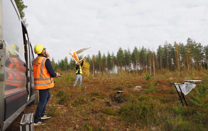
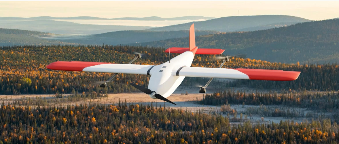
- Drone EM System by Radai Oy: Drone-based geophysical surveys.
- advangeo® 3D Prediction Software by Beak Consultants GmbH: the software will undergo testing and adjustments to integrate data from the geoscientific 3D models, showcasing workflow effectiveness.
- GisSOM Software by Geological Survey of Finland (GTK) / Geologian tutkimuskeskus (GTK): Integrates 2D data and improves compatibility with Windows 11.
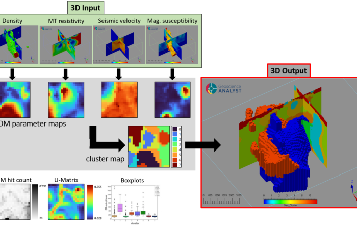
- 3D Inversion Software by Geological Survey of Finland (GTK) / Geologian tutkimuskeskus (GTK): Optimized for faster data turnaround and improved usability, achieved through better automatic data transfer and workflow efficiency.
DroneSOM – more precise, efficient, and environmentally friendly mineral exploration
DroneSOM (Drone Geophysics and Self-Organizing Maps) aims to harness drones and machine learning to improve the current mineral exploration methods.
By combining cutting-edge scientific research with drone industry expertise, the project partners aim to launch a comprehensive set of new machine learning tools and methodologies for commercialization in 2025.
Test surveys


Surveys for mineral exploration companies
DroneSOM specializes in advanced drone electromagnetic surveys, delivering precise and reliable data collection for various applications. Our services are enhanced by cutting-edge data integration tools, utilizing state-of-the-art software solutions such as 3D inversion, 2D GisSOM, and Advageo 3D Prediction software. This allows us to provide comprehensive analyses and visualizations, enabling you to make informed decisions based on high-quality data insights.
Commercially available
DroneSOM.speed is an extension of the DroneSOM project, with the primary goal of offering drone-based electromagnetic (EM) surveys and data integration services. Development and testing of the new exploration systems and software will continue until the end of 2025. All the services will be available for purchase from Radai Oy, paving the way for new opportunities in commercialization and application across various industries.
Efficiency with significantly smaller environmental impact
To achieve efficiency and reduce environmental impact, innovative drone-based geophysical measurement techniques and software solutions will enhance mineral exploration. These advancements will enable precise, efficient, and eco-friendly measurements, while data integration tools will combine multiple geophysical maps for faster and more accurate results, improving workflow efficiency.

Fast

Precise

Environment friendly