Modernizing mineral exploration methods with advanced drone technology
DroneSOM services integrate electromagnetic (EM) drone services along with software products designed for geophysical measurements and data interpretation in mineral exploration.
Radai Ltd has created a lightweight electromagnetic drone called Louhi, which consists of an EM receiver unit and an EM transmitter unit (ground loop). The drone tows the receiver unit, and a large transmitter loop is placed on the ground. The system is ideal for mineral exploration targeting 100-500 meters depth penetration.

Radai’s Louhi electromagnetic drone

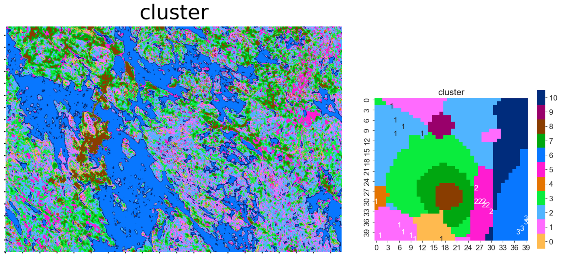
Geospace (left) and SOM clusters (right) map of a study area.
Software solutions for easier data interpretation
GTK is developing advanced 3D frequency-domain electromagnetic inversion techniques to analyze datasets collected by drones. This includes a modified and tested software solution for generating 3D models based on processed geophysical data obtained from drones. The software produces 3D electrical conductivity models from drone electromagnetic data. It is specifically designed to address the challenges and unique issues associated with these types of datasets.
The “GisSOM” software developed by GTK is a market-ready service designed for mineral exploration. It integrates 2D geospatial data using self-organizing maps (SOM) and k-means clustering, enabling users to understand data structures, identify clusters, and visualize results related to mineral deposits. With further adaptations, GisSOM can also be applied to various other geoscientific applications, such as environmental monitoring.
The “advangeo® 3D Prediction” software by Beak Consultants GmbH is a powerful tool that seamlessly integrates various 3D data sources exploration targets with high mineral potential in the subsurface. With the recent addition of self-organizing maps (SOM) for data clustering, the software enhances its capabilities for predictive analytics. It has already established itself with advanced supervised predictive mapping using artificial neural networks (ANN). While it is specifically designed for mineral exploration, its versatility makes it an excellent choice for general geological data integration and critical applications in geo-risk analyses and hydrogeological studies.
