The ongoing advancements in “advangeo® 3D Prediction” software development within the DroneSOM project aim to significantly enhance geoscientific data integration and mineral prospectivity analysis in 3D space. Leveraging the self-organizing maps (SOM) method from GTK’s nextsomcore, pioneered within the Horizon 2020-funded project NEXT (“New Exploration Technologies”), the Geological Survey of Finland (GTK) and Beak Consultants GmbH (BEAK) have been spearheading the integration of SOM into advangeo® 3D Prediction software.
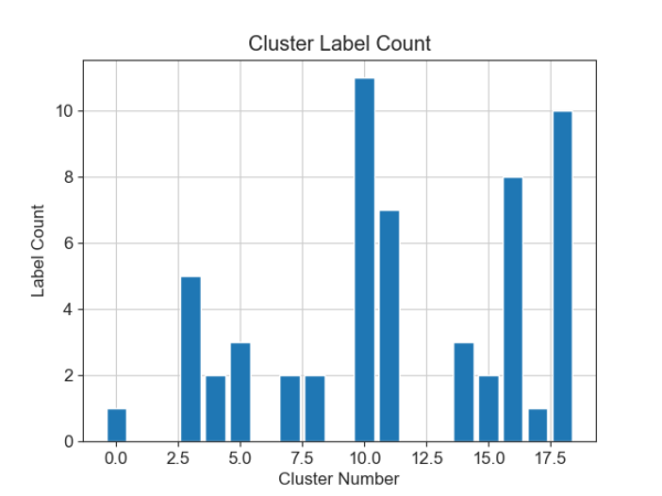
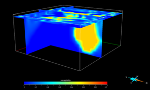
The current focus includes the integration of SOM clustering for geophysical data, particularly utilizing 3D inversion results from gravimetric, magnetic and electromagnetic datasets (Figure 1). This entails expanding the capabilities of advangeo® 3D Prediction to import data with file formats that are common for these 3D inversion results. Additionally, it includes accommodate SOM computation and reporting (Figure 2), including metrics such as SOM maps with spread of variables within nodes, SOM map with mean quantization error (QE) of data points within each node, map embedded accuracy for calculating population-based test statistics, and topological errors. These quality measures can also contribute to SOM convergence optimization.
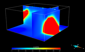
Figure 1: 3D input data (voxet) for Pomocaira test case. Susceptibility (left) and density (right) from inversion of magnetic and gravimetry data.
Additionally, the development efforts aim to enhance the user interface of advangeo® 3D Prediction to facilitate the specification of SOM input parameters and to provide comprehensive visualization tools for SOM results. The goal is to streamline the process of assessing result quality by incorporating SOM-related uncertainties into subsequent supervised classification workflows, thereby enhancing prediction modeling with artificial neural networks (ANN) using SOM codebook vectors.
Furthermore, the software is being enhanced to accommodate a wider range of open-source tools for creating and visualizing Voxet files, ensuring independence from additional commercial software packages and broadening accessibility to potential clients.
In conclusion, the ongoing advancements within the DroneSOM project are geared towards elevating advangeo® 3D Prediction into a comprehensive solution for geoscientific data integration in 3D. By leveraging SOM clustering and expanding the software’s capabilities, the aim is to revolutionize mineral exploration and other geological data integration endeavors, offering enhanced accuracy, efficiency, and versatility.
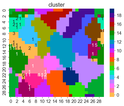
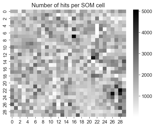
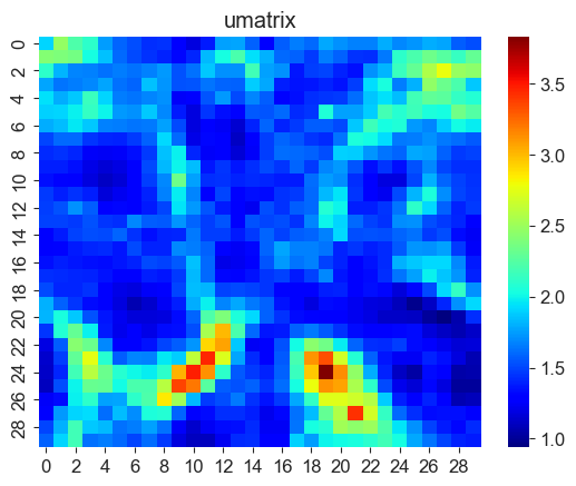
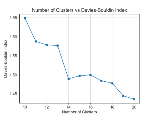
Figure 2: SOM and k-means cluster result including quality measures and label evaluation.
