Reports
Technical reports about drone-based electromagnetic geophysical measurements and software solutions for easier data interpretation using GisSOM, Advangeo® 3D Prediction, and 3D geophysical inversion software.
Please request report(s) thought dronesom(at)dronesom.com
Final version of the drone-based EM survey system implemented
Unoccupied aerial vehicles (UAVs), also known as drones, have become useful tools in many areas of human activities during the last few years. In geosciences, drones are used to carry sensors and instruments the data from which can then be used to investigate the topography, geography, and geology of the study area. Geophysical data (e.g., magnetic and gravity field) arise from the depths of the earth, and therefore, the interpretation of the data gives information on the structure and composition of the geology of the subsurface. To retrieve this information, numerical modelling and inversion tools are usually needed. In DroneSOM project, Radai Ltd is developing a drone-based geophysical electromagnetic (EM) survey system named Louhi. Depending on the type of EM transmitter the Louhi system is either fully airborne, if a small transmitter loop is carried by a drone, or semi-airborne, if a fixed transmitter loop is located on the ground.
Data collection and integration at site 1, including validation against existing data and models
his study aimed to demonstrate and validate the integration of field measurements, improved 2D Self-Organizing Map (SOM) techniques, and a newly developed 3D SOM approach for geophysical data analysis. The research was conducted at the Erzgebirgsnordrand (ENR) test site in the Ore Mountains, Germany, an area of interest for critical mineral resources such as Sn, W, and Li. The primary objective was to assess the effectiveness of these methodologies in characterizing geological structures, particularly a hypothesized granite intrusion, and to evaluate the software developed within this project.
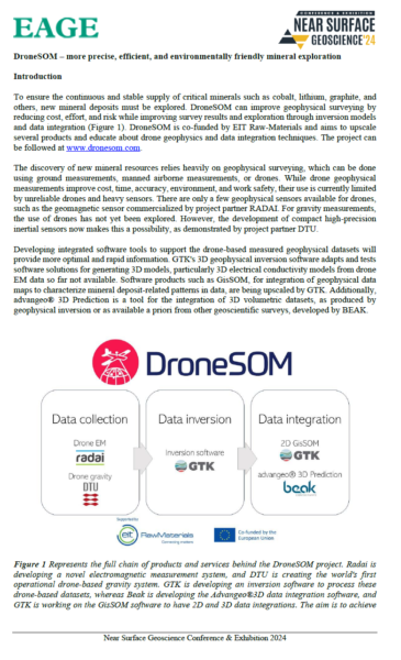
NSG 2024 abstract: “DroneSOM – More Precise, Efficient, and Environmentally Friendly Mineral Exploration”
To ensure a steady supply of critical minerals like cobalt, lithium, and graphite, exploring new mineral deposits is crucial. DroneSOM enhances geophysical surveying by reducing costs, effort, and risk while improving outcomes with advanced inversion models and data integration. Co-funded by EIT Raw Materials, the project aims to develop products, promote education in drone geophysics, and provide services.
DroneSOM utilizes drone-based measurements and integration softwares to discover new mineral resources. Drones offer advantages in cost, time, accuracy, and safety, although past challenges with heavy sensors and technology have limited their effectiveness. DTU’s and Radai’s recent advancements in compact, high-precision inertial sensors are improving drone-assisted in EM and gravity measurements.
Essential software tools help manage drone-based geophysical datasets. GTK is enhancing its 3D inversion software for drone data, while BEAK’s advangeo® 3D Prediction integrates various geophysical datasets.
Overview of global technology trends in geophysical drone use in open literature plus candidate drones for geophysical sensors with specified power/weight needs
Remote sensing methods and applied geophysics techniques gather information about subsurface structures without disturbance. Airborne surveys are preferred due to their speed, safety, and cost-effectiveness. Drone-based geophysical surveys are versatile, fast, economical, and ecologically friendly. However, drone payloads have limitations. Some geophysical methods are unsuitable for drones, and some may be prohibited by law. Drones have new opportunities in mining operations, especially for local scale support for ore and top cover volume estimations by repeated photogrammetry and lidar, constructions (roads, buildings), and a general understanding of geological bodies in large-scale pit mining, e.g. by hyperspectral imaging. Geophysical exploration requires larger drones for longer ranges. Magnetic measurements are the most mature technology, while electromagnetic sounding and gravimetry are still developing. The DroneSOM EIT project 2022-25 will develop these techniques.
Fixed-wing drone purchase and first test flights with dummy weight (sensors)
Radai Ltd is developing a drone-based geophysical electromagnetic (EM) survey system called Louhi. It has two modes of operation – one uses a large loop on the ground as an EM source, while the other uses a small portable loop EM transmitter. Both systems utilize a lightweight 3-component EM receiver towed by a drone. The drone must be powerful, stable, and customizable to carry a payload of 2-3 kg in difficult weather conditions.
The first section describes Radai’s process of selecting the optimal drone platform for conducting EM surveys in the DroneSOM project.
The second section details the first flight tests conducted with the new drone platform and EM system.
Louhi is sensitive to variations in the electrical resistivity and magnetic permeability of the medium. As an airborne drone-based EM system, it avoids obstacles such as lakes, rivers, swaps, and ravines, making it safer and more cost-effective than ground EM surveys, especially in rugged terrain. Compared to manned aircraft, drone surveys are versatile, fast to deploy, economical, and ecologically friendly. However, the modest payload of drones imposes restrictions in the design and building of a drone-based EM system.
Report on purchase of separate drone IMU sensor for gravity, tests in airborne domain, first test flights with IMU
DTU Space is developing a gravity system based on an unmanned aerial vehicle (UAV) with a moving platform. The goal is to make the operation feasible by exploring new sensor systems. A new configuration called the strap-down configuration of an Inertial Measurement Unit (IMU) has many advantages over traditional gravity sensors. The IMU is physically fixed to the chassis of the aircraft, making it simpler, smaller, lighter, and requiring less power. DTU Space has been operating a strap-down IMU system routinely for gravity surveys since 2016. The current system, iCORUS1, weighs around 18 kg and consumes up to 175 W of power. Within the DroneSOM project, DTU Space is searching for alternative sensors.
Report on optimized software based on first test campaigns
The optimized gravimetry software’s status based on the first test campaigns for production flights at validation sites is reported. The software was developed using the DroneSOM test flight at Lindtorp Airfield, Denmark, and the first production flights in Sokli, Finland. The current software version was successfully used in processing an airborne campaign conducted by DTU Space on behalf of Kartverket. Further studies of GNSS tracking and interference will be conducted before the next field campaign. Finding an appropriate landing place for a fixed-wing drone is difficult, and a natural countermeasure is to localize alternative landing sites in advance.
Lintumaansuo integration tests of the drone-based EM system
Drones or Unoccupied Aerial Vehicles (UAVs) are used in geosciences to obtain data for investigating the topography, geography, and geology of an area. In the DroneSOM project, Radai Ltd is developing a drone-based geophysical electromagnetic (EM) survey system called Louhi. Louhi is based on EM induction and is sensitive to variations in the electrical conductivity of the subsurface materials. As an airborne drone-based EM system, Louhi avoids terrain obstacles and is safer and more cost-effective than ground EM surveys. This report describes the status of the semi-airborne version of the Louhi EM system and its towed receiver installation. It presents preliminary results from the airborne field test conducted in Lintumaansuo in Oulu, Finland, at the end of June 2023.
